Mapping and Modeling
Get a bird’s eye perspective
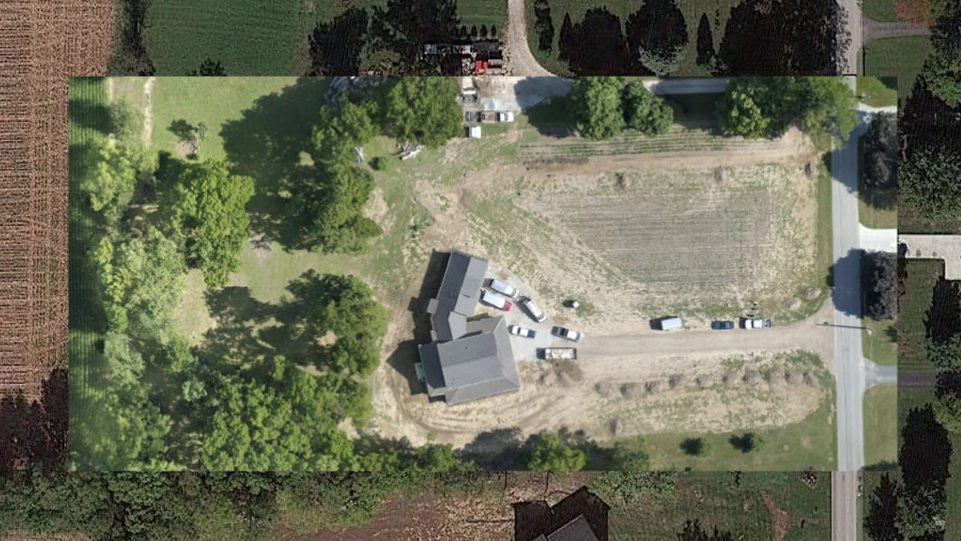
Get a high resolution overhead perspective of your property, roof, or jobsite with aerial mapping.
Aerial mapping and modeling allows you to easily measure distances, plan out your project with cut and fill analysis, and keep a permanent record of progress and installation. These services can be purchased on a one-time basis or on a monthly contract.

PROCESS
1
Request Quote
We provide prompt communication, quote response will be sent within 24 hours of request.
2
Flight Scheduled
Contract is signed, payment is made. Then we plan out the flight, taking into account weather and airspace restrictions.
3
Drone Capture
We map out your property for the drone to capture hundreds of images to be stitched together.
4
Receive Deliverables
We provide you with the 2D/3D map in the desired format for ease of use.
Examples
This is a 2D orthomosaic map of a horse ranch. This map is compiled of 290 high resolution images stitched together for extreme detail.
View elevation changes in your land with an overhead perspective. This tool can be used for leveling out farmland or construction sites very efficiently.
Mapping allows us to create 3D models to show elevation changes and typography. This can be used for construction buildings as well.
Maps allow us to take volumetric measurements of stockpiles to better predict earthworks requirements.
Single Overhead Image
Orthomosaic image: This is a series of images taken and geometrically corrected to be scale and uniform, making one large image 2D or 3D.
FAQ’s
Our pricing for mapping missions consists of multiple factors: size of map, drone flight time, level of accuracy, and type of deliverable needed.
Unlike a regular photo, an orthomosaic image is a series of images taken and geometrically corrected to be scale and uniform, which can be used to measure true distances since it is an exact representation of the earth’s surface.
During the preflight planning process, we research your job location to see if there are any flight restrictions. If the location is in controlled airspace, we will request an authorization with the FAA for your flight.
Online Reviews

3 years ago Read More
JCL Aerial did amazing work for our company. The quality of work was above and beyond what we asked for. Jacob is a professional at what he does and dealt with our employees and customers with respect. I would recommend this company and the workmanship of his work is excellent.

3 years ago Read More
Extremely professional and easy to work with. We ordered an aerial inspection and had the pictures within a few hours of completion. The pictures were high resolution and very detailed. Highly recommend their services.

3 years ago Read More
We used JCL for four locations. Jacob was very flexible with respect to scheduling due to weather issues. Final product was terrific. Highly recommend.

3 years ago Read More
We used JCL for four locations. Jacob was very flexible with respect to scheduling due to weather issues. Final product was terrific. Highly recommend.

